


New Public Map Tool Lets Owen Sound Residents Explore Local Services and Data
Want to know your garbage day or nearest park? Owen Sound’s new map puts local info in one place. Here’s what it shows (and what it doesn’t).

The City of Owen Sound has launched a new online mapping tool that gives residents access to a variety of civic information, from zoning bylaws and transit routes to park locations and heritage plaques.
The interactive Geographic Information System (GIS) map is now live on the City’s website. It’s designed for public use and includes no private or sensitive data. Instead, the tool compiles existing information into a unified format that allows users to explore city services through a set of layered maps.
Available to the public and free to use, the map includes:
Zoning and Grey Sauble Conservation Authority regulation lands
Parks, trails, city-owned trees, and heritage plaque locations
Transit routes and bus stop information
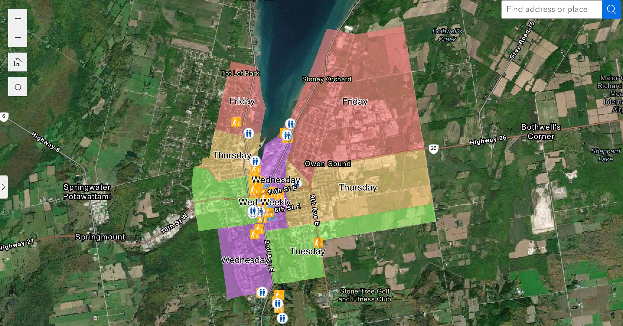
Waste collection zones
Public washroom locations
The map is optimized for desktop and laptop use but can be accessed on tablets and smartphones. The City says mobile responsiveness will improve with future updates.
A disclaimer on the site notes that the map is not intended for precise measurements or legal use. It reads:
“Please be aware this map is for illustrative purposes only. Do not rely on this map as being a precise indicator of routes, location of features or surveying purposes. This map may contain cartographic errors or omissions. Parcel boundaries are approximation; for precise locations please contact your local Land Registry Office.”
Under the “Civic Information” view, users can find details like public washrooms, waste pickup days, and historic plaques.
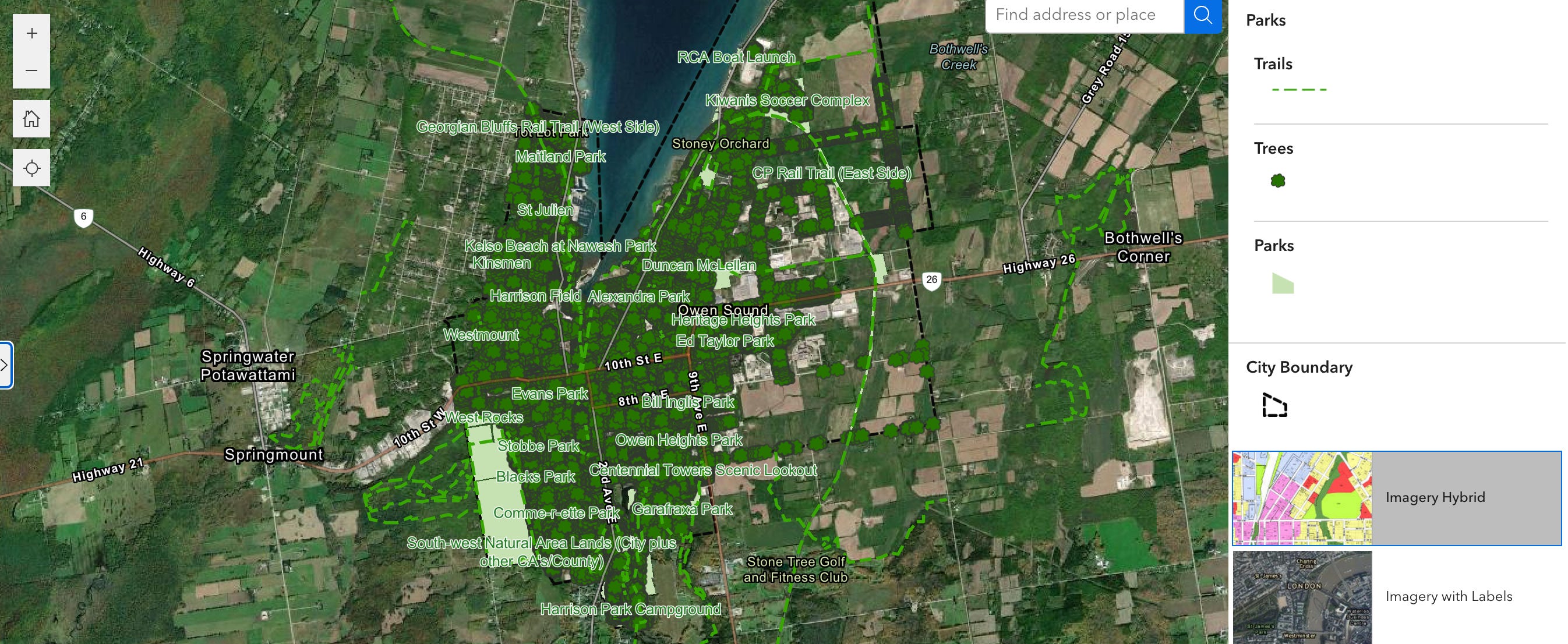
The “Parks” view highlights local trails and greenspaces (though some labels, in green text with a white outline, are difficult to read).
The “Planning” view displays zoning information and related land use data.
The map focuses on making public service information more accessible, but there are limits to what it includes. It doesn’t show who owns a property, current building permits, or live updates like bus arrival times. Users won’t find detailed environmental data such as flood risk maps or soil conditions, and there’s no layer for development applications in progress.
It’s meant for general orientation, not real-time tracking or technical planning. But if you’re looking for basic zoning details, transit routes, park locations, or waste pickup information, it’s an accessible and convenient way to find it.
Residents can access the new GIS map from the City’s website, with a link featured partway down the homepage. More updates and tutorials are expected in the weeks ahead.